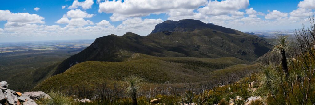
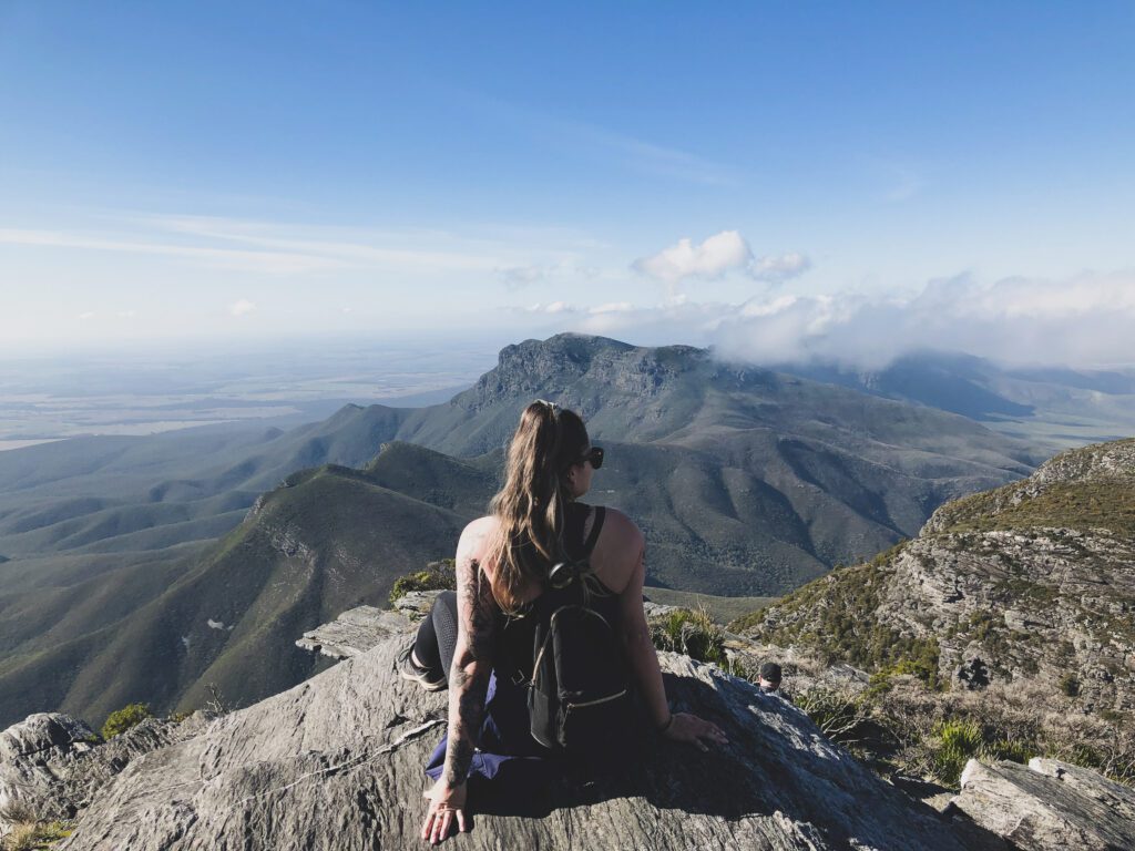
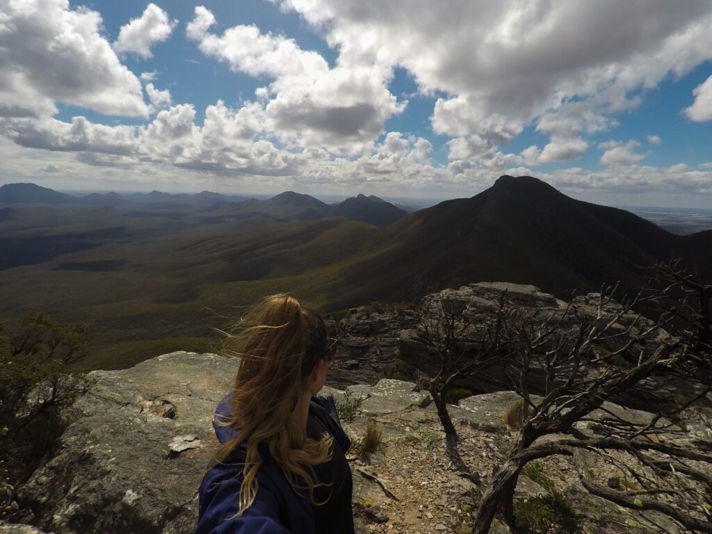
Hiking, mountain landscapes, and star-filled skies. The Stirling Ranges are a nature lovers paradise. This National Park is the only major mountain range within the southern half of Western Australia. It’s roughly 1,157 square metres, with the highest point at Bluff Knoll (1,096m). This area was first sighted in 1802 by Mathew Flinders. It was named after Sir James Stirling, who was the first governor of the state. In 1957 the whole range, and part of the surrounding plains, became the Stirling Range National Park.

Where is it?
Located roughly 400 kms or 4.5 hours from Perth CBD, it makes for a great weekend getaway. If you are travelling from Albany, it is roughly 80 km or an hour drive.
You can only access the Stirling Ranges by car. A 4WD is not needed. However, some of the roads are unsealed, but kept in very good condition.
Best Time to Visit?
The National Park is beautiful to visit all year round. Based on experience, I wouldn’t recommend visiting in the peak of summer, when temperatures can reach 40 degrees Celsius. The best time to visit is spring or early summer, when the days are warm, the nights are cool, and the wildflowers are blooming.
Where to stay?
There are only two places you can stay in the National Park, Stirling Range Retreat and Mt Trio Bush Camp/Caravan Park.
Stirling Range Retreat
This is the best place to base yourself if you wish to do Bluff Knoll for sunrise, as it’s only a 10-minute drive to the Bluff Knoll Car Park. The retreat has many accommodation options on offer including: onsite caravans, camping (powered or unpowered), motel style rooms, park cabins, and chalets. You can expect to pay anywhere between $16-$195 AUD per night, dependent on your accommodation choice.
Mt Trio Bush Camp and Caravan Park
This accommodation is situated in the natural bush on a working farm, boarding the Stirling Ranges. It’s a little further out than the above accommodation, so if you choose to stay here, keep in mind you will need to drive further to access the hikes. There are only two accommodation options on offer here, powered camping and unpowered camping. You can expect to pay $42 AUD per couple for a powered site and $32 AUD per couple for an unpowered site.
What to see and do?
I’ll be honest, there isn’t much to do in the Stirling Ranges besides a few scenic drives, and lots of hiking. Even if you are not a massive hiker, at least complete Bluff Knoll! There are heaps of hikes available in the National Park ranging in difficulty from easy to extremely challenging. Keep in mind that some level of fitness is required, even for the shorter ones.

Bluff Knoll
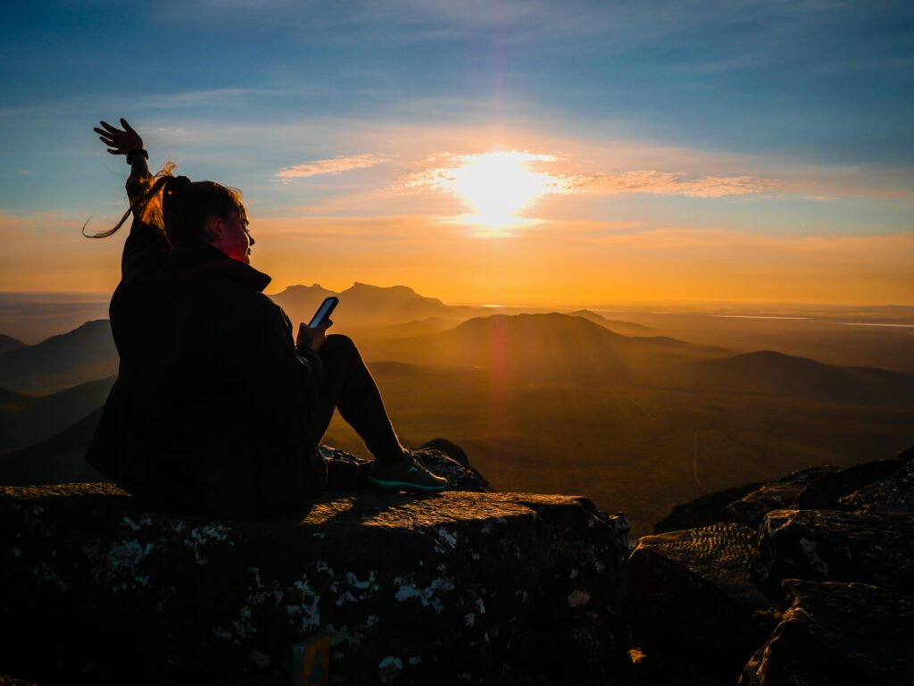
The most popular hike in the National Park and the most well maintained. This 6 km return hike is made up of mainly steps leading to the summit (prepare your calves!). It has a 20% gradient, so it is challenging in some areas. However, I have seen people of every age reach the summit, so just take your time. You will need roughly 4-6 hrs to complete this hike, depending on your fitness level. I highly recommend you complete this hike for sunrise. If you are lucky, and the weather conditions are favourable, you might get to experience the blanket of clouds.
If you are summiting for sunrise, bring a light and warm clothes as it does get quite cold at the summit.
Mt Toolbrunup

A slightly shorter walk. Mt Toolbrunup is a 4 km return, grade 5 hike. It is the second highest peak in the Stirling Ranges, with the summit towering over the western peaks. At the summit you will be delighted with uninterrupted views of the ranges. If you decide to take on this hike, just keep in mind it requires a bit of rock scrambling and steep climbs.
Talyuberlup Peak
Another challenging grade 5 hike, however, shorter in distance with only a 2.5 km return. At the summit you will be rewarded with amazing views of the surrounding mountains and plenty of rocky outcrops to explore.

Mt Magog
A 7 km return, grade 5 hike. This should take roughly 2-3 hrs to complete, depending on your fitness level. This is one of the lesser walked hikes in the National Park and only rises 856 meters. This hike offers more of a wilderness experience than the other peaks. The track isn’t as well maintained as other hikes in the park, so it may be overgrown in some areas.
Mt Trio
This is the shorter favourite of the Stirling Ranges. This 3.5 km return hike starts with a steep climb up some steps. Don’t worry this is the hardest part of this hike! Once you’ve overcome the steps and reached the saddle, it’s an easy walk to the summit. Mt Trio comprises of three peaks, once known by its Aboriginal name Warrungup, meaning “three become.”
Stirling Range Ridge Walk
I want to start off by stating you should not attempt this hike if you are not an experienced hiker with a great level of fitness. This is the only alpine walk in Western Australia and weather conditions can change rapidly. It involves ridge walking, so I wouldn’t recommend this to anyone who has a fear of heights. This hike is roughly 19.5 km long, tracking along the ridge from Bluff Knoll to Ellen’s Peak. Although this trail is challenging it offers the best views of the Stirling Ranges.
If you are going to attempt this hike, keep in mind you will need to carry everything with you. There is only one source of water on the hike, a barrel, which is only full seasonally. There are no bathrooms, and the trail is very easy to lose. I recommend doing extensive research before you venture out on this hike.
Mt Hassel
Another of the shorter hikes in the National Park, a 3 km return. This is a good hike to complete if you are looking for the same views as Toolbrunup Peak, without the challenge.
The Stirling Range National Park is a beautiful landscape, which is well worth visiting if you are ever in Western Australia. Even if you are not a hiker, I still recommend you visit and give Bluff Knoll a try! Who knows, you might discover a new passion while you are at it.
Want to find out more about the Albany and surrounds and build an itinerary? Check out this blog!
All images by Becky Hamilton. Find her Instagram here.
